The Serra do Tabuleiro State Park (in Portuguese: Parque Estadual da Serra do Tabuleiro) was established in 1975 based on the scientific studies of the botanist Father Raulino Reitz and the botanist and ecologist Roberto Miguel Klein, with the aim of protecting the rich biodiversity and water sources of the region.
Location
The Park occupies about 1% of the territory of Santa Catarina, with areas in the municipalities of Florianópolis, Palhoça, Santo Amaro da Imperatriz, Águas Mornas, São Bonifácio, São Martinho, Imaruí, Paulo Lopes, and Garopaba. It also includes the islands of Siriú, dos Cardos, do Largo, do Andrade, and do Coral, as well as the archipelagos of Três Irmãs and Moleques do Sul, making it the largest full protection Conservation Unit in the state.
When to visit
Serra do Tabuleiro State Park stays open fromWednesday to Sunday, from 9am to 5pm.
As of 2024, entrance is free.
Attractions
Located near major urban centers, the Park has enormous potential for public use and leisure activities, combining ecotourism with environmental education and sustainable development of surrounding communities.
Check out what to do in Serra do Tabuleiro State Park:
Visitor Center and sand forests
The Park has its headquarters in the municipality of Palhoça, in the Baixada do Maciambu. The headquarters features a Visitor Center with educational trails and a qualified staff, where the public can come into contact with nature, approach this biodiversity giant, and learn more about the riches of the Atlantic Forest and the Park.
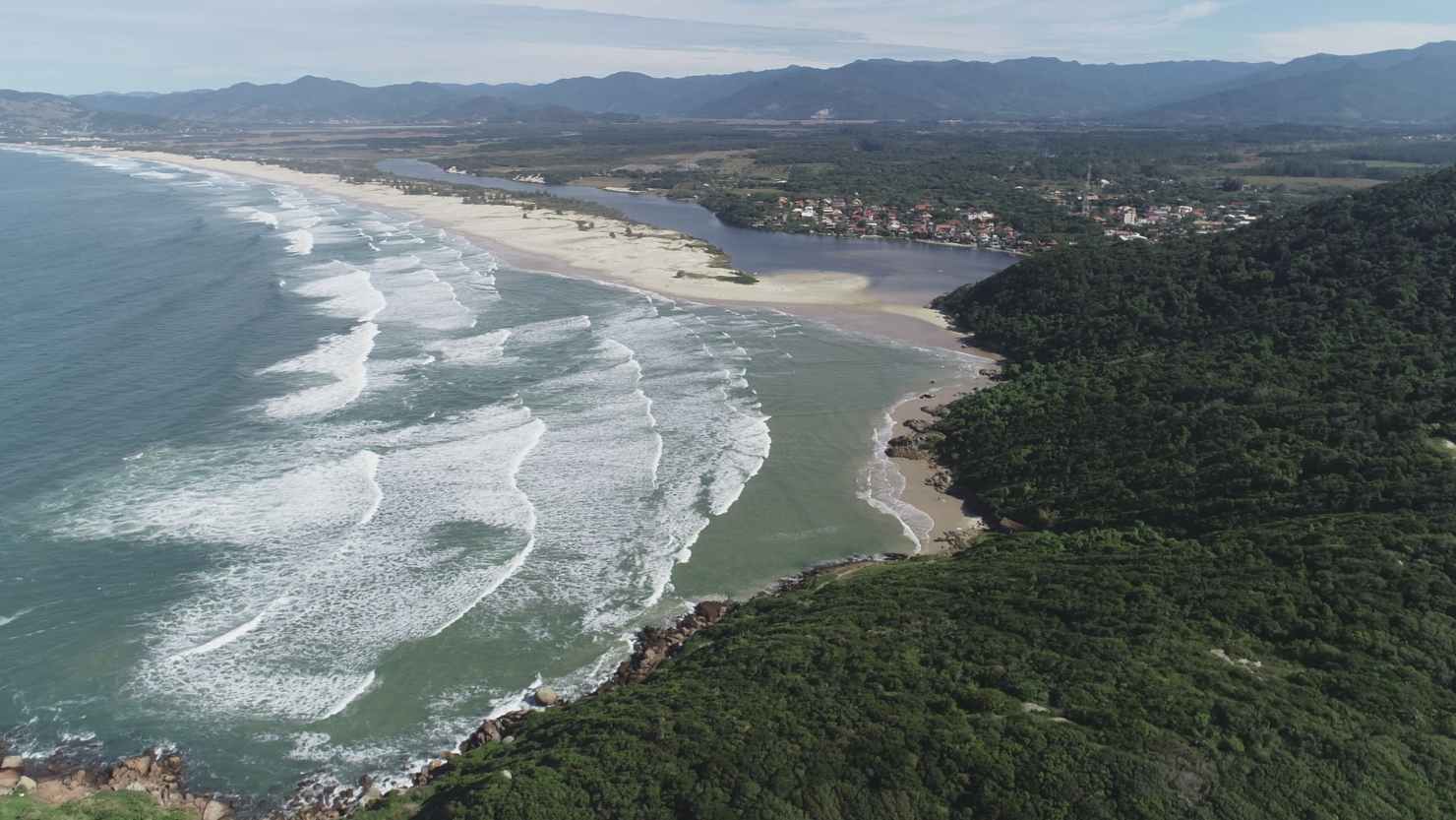
At the Park’s Visitor Center, visitors can enjoy the Interpretive Trail of the Maciambú Restinga (sand forest), which provides infrastructure for educational processes through awareness and understanding of the importance of the restinga ecosystem, as well as nature conservation. It is also possible to visit an important geological monument: the sandy ridges, in the form of semicircles, which are the result of sea level fluctuations over thousands of years.
Morro do Cambirela trail
One of the most sought-after spots for those who want to explore more of the park is the Morro do Cambirela trail (Cambirela hill trail), located in Palhoça, and it is one of the main landmarks of the park.
The ascent is one of the best trekking options in the entire state, considered a trail of high difficulty level, requiring good physical preparation to reach the peak of the hill, at over 1,000 meters above sea level.
Therefore, it is always recommended to hire a qualified guide for longer trails, and always inform a family member or friend about the activity you are going to undertake.
Serra do Tabuleiro Crossing
Other attractions include short and long-duration trails amidst nature, such as the Serra do Tabuleiro Crossing, which connects Santo Amaro da Imperatriz to São Bonifácio through untouched forests and high-altitude fields until reaching the Pico do Tabuleiro at 1,260 meters above sea level.
The Pico do Tabuleiro (Tabuleiro peak) represents one of the main elements of the local landscape, and it is possible to have a view of Florianópolis Island and the slopes of the Serra Geral. In the region, there are also several options for mountain bike routes of up to 15 km that pass by waterfalls, streams, and other enchanting landscapes.
Facts about Serra do Tabuleiro State Park
Biodiversity
The name of the park originates from one of its mountains that has a tabular-shaped summit, very visible from the Florianópolis region: the Serra do Tabuleiro (literally translated into: Board Mountain Range). The park encompasses a unique and special area of the Atlantic Forest, with a wide diversity of habitats and vegetation formations. For example, five of the six major vegetation formations of the Atlantic Forest biome in Santa Catarina are represented in the Park. For this reason, it harbors even more biodiversity than its 84,130 hectares might suggest.
Along the coast, under the marine influence, there are restinga and mangrove formations. The Dense Ombrophilous Forest, rich in epiphytic plants and biodiversity, covers the mountains and occupies most of the Park’s area. In the upper slopes of the mountain, shrouded in mist formed by the condensation of moisture from the sea, the cloud forest appears. In the highest parts of the Park, the Mixed Ombrophilous Forest (Araucaria Forest) and the high-altitude grasslands are present.
Each ecosystem has its characteristic fauna and flora, as well as its dominant species. The coastal islands that are part of the unit also present their own peculiarities. The vast number of species and vegetation, some practically untouched, make the Serra do Tabuleiro State Park one of the main treasures of Santa Catarina; therefore, the park is essential for the protection of ecosystems and all their biodiversity.
Topography and hydrology
Additionally, it is also worth highlighting the protection of thousands of springs, some crucial for the development of their regions, such as the springs of the Vargem do Braço, Cubatão, Madre, and D’Una rivers. These rivers provide water to a large part of the households in the Greater Florianópolis area and the southern coast of the state, supplying quality water to more than 1 million inhabitants. Due to its soil, relief, and vegetation characteristics, the Park also acts as an important climatic regulator for these regions.
Still within the Park area, in the municipality of Palhoça, is the Baixada do Maciambu, a plain that holds one of the most expressive restinga landscapes on the Brazilian coast. Formed by sandy ridges in the shape of semicircles, resulting from sea level fluctuations over thousands of years, the region is considered an important geological monument in southern Brazil. Due to its unique and representative characteristics, the Serra do Tabuleiro State Park is an unparalleled research field.
Leave a Reply